
|
|
||||||||||||||||||


| 2026-2027 Electoral Calendar, latest official version |

|
 |
|
|
|
|
|
|
|||||||
|
|
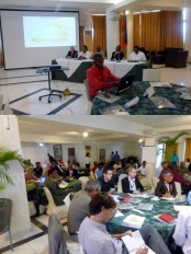
Haiti - Technology : Forum of User of Geo-spatial informations in Haiti - GEOTECH 2012
Mr. Boby Emmanuel Piard, CNIGS Director explained that the purpose of this forum is to bring closer the data users of CNIGS so that they can know the institution, its tools and technologies used "This forum represents the link between the CNIGS and users of geo-spatial informationn," hoping that users make of the geo-spatial informations, mapping, and geomatics a tool for planning and of aid to management. For Mr. Yves Robert, Director of the Ministry of Planning and External Cooperation (MPCE), these 3 days of reflection, of work can "clearly show the importance and the key role that GIS can play in Haitian institutions as a support to the decision making..." Ms. Marie Carmelle Rose Anne Auguste, Minister Delegate to the Prime Minister for Human Right and the fight against extreme poverty for her part declared "... My deep conviction is that the rational exploitation and continuous of this tool that is the CNIGS, by the Government, would allow it to acquire a relevance of the dimension 'spatial and territorial' relevance of the dimension, spatial and territorial 'of its actions never reached so far, to articulate, in its capacity consistent of prioritization of actions in an economic context limited and in the knowledge spatialized and exhaustive (mapping) of all the state intervention and those of private partners on the ground, in order to visualize the impact or deficits at the geographical scale. [...] My recommendation remains that all sectoral departments of government and of the civil society and the private sector which, directly or indirectly, have a need for specific spatial information, or a complex spatial analysis [...] of their data [...] can appeal systematically to the support and skills of CNIGS. The government would benefit from gain to use at maximum the tool CNIGS, to allow public opinion, to the development partners to better appreciate the significance of his actions. The CNIGS, should be able to reinforce, to train Executives of the Public Service in order to allow each sectoral ministry to have a unit dedicated to the analysis, for the purposes of exploitation, of geospatial data that will be treated at CNIGS, on a regular basis. The systematic use of the tool CNIGS, in all spheres of development and of implementation of the governmental action remains an imperative of the governance of quality sought. So I would advocate the use of this instrument in the monitoring of three-year plan, to enable development partners to strengthen their cooperation with the government. [...] It would be highly beneficial and productive that a partnership be done between CNIGS, and faculties in the fields of social sciences, pure sciences, agriculture, environment and communication, among others [...]" S/ HaitiLibre
|
|






|
|
Why HaitiLibre ? |
Contact us |
Français
Copyright © 2010 - 2026 Haitilibre.com |